Real Estate Drone Video Canada: 2026 ROI Guide
- Why Drone Video Has Become a Listing Tool, Not Just a Luxury Add-On
- Transport Canada Rules: What Realtors Need to Know
- Typical Real Estate Drone Video Costs in Canada
- Best Uses for Real Estate Drone Video in Canada
- When Drone Video Is Not Worth It
- What a Strong Drone Shot List Should Include
- The Local Insight: Buyers Want Context Before They Visit
On a cold morning outside Ottawa, a listing agent has one problem: the home is beautiful, but the first photo from the curb does not explain why it matters. The house sits on a deep lot, backs onto mature trees, and is five minutes from a commuter route. From the street, it looks like another detached home. From the air, the story changes.
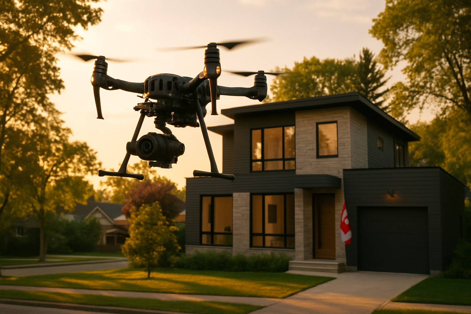
That is the real value of real estate drone video in Canada. It is not just a dramatic opening shot. It is a way to show scale, setting, access, privacy, waterfront, acreage, ravines, skyline views, neighbourhood context, and lifestyle in a few seconds. In competitive markets like Toronto, Vancouver, Ottawa, Barrie, and growing suburban communities, aerial footage can help buyers understand the full property before they ever book a showing.
But drone video also comes with rules, costs, weather limitations, and creative decisions. Used well, it can elevate a listing. Used poorly, it becomes expensive filler. Here is what Canadian agents, sellers, and property marketers should know in 2026.
Why Drone Video Has Become a Listing Tool, Not Just a Luxury Add-On
A few years ago, aerial video was mostly reserved for estates, farms, waterfront homes, and luxury listings. Today, it is becoming more common for mid-market properties where location is part of the value.
In Toronto, drone video can show proximity to parks, transit, schools, ravines, and walkable retail pockets. In Vancouver, it can reveal mountain views, ocean access, slope, lot orientation, and neighbourhood density. In Ottawa, drone footage is often useful for suburban homes, estate lots, new developments, and properties near greenbelt land or waterways.
The best drone footage answers a buyer question. How private is the backyard? How close is the lake? What surrounds the condo tower? Is the lot larger than it looks? Does the home sit on a quiet street or a busy route? When aerial video clarifies something valuable, it earns its place in the marketing package.
Transport Canada Rules: What Realtors Need to Know
Drone work in Canada is regulated by Transport Canada. For real estate marketing, the most important point is simple: hire someone who understands Canadian RPAS rules, carries proper insurance, and knows how to plan legal flights around people, buildings, roads, airports, and controlled airspace.
For drones between 250 grams and 25 kilograms, the drone generally must be registered, and the pilot must hold the appropriate certificate. Basic operations usually apply when flying in uncontrolled airspace, away from bystanders, and not over people. Advanced operations may be required when flying in controlled airspace, closer to people, or in more complex environments. Controlled airspace often requires authorization through NAV CANADA systems before the flight.
Micro drones under 250 grams are treated differently, but they are not a free pass for careless commercial work. Pilots still must not fly in a way that endangers people or aircraft, and they still need to consider privacy, local restrictions, property permissions, and safe operating conditions.
For agents, the practical checklist is straightforward:
- Ask whether the pilot is certified for the type of operation required.
- Confirm the drone is registered when required.
- Ask about liability insurance for commercial aerial work.
- Check whether the property is near an airport, heliport, hospital pad, or controlled airspace.
- Confirm the pilot will not fly over crowds, active roads, or neighbouring private areas unsafely.
- Plan for weather, wind, construction, and privacy concerns.
In dense markets like downtown Toronto or Vancouver, drone approvals and flight planning can be more complicated than in a quiet rural setting. That does not mean drone video is impossible. It means it should be planned professionally.
Typical Real Estate Drone Video Costs in Canada
Pricing varies by city, property size, travel distance, licensing complexity, edit length, and whether drone footage is part of a larger photo and video package. In most Canadian markets, drone is priced either as an add-on or as part of a cinematic listing video.
Typical 2026 ranges look like this:
- Drone photo add-on: about $150 to $300 for a small set of aerial stills.
- Drone video add-on: about $250 to $600 when added to a standard listing shoot.
- Photo, video, and drone package: about $600 to $1,500 for many residential listings.
- Luxury, acreage, waterfront, or development video: about $1,500 to $3,500+ depending on planning, crew time, edit complexity, and deliverables.
- Extra flight planning or restricted airspace coordination: may increase cost when approvals, scouting, or scheduling flexibility are needed.
Toronto and Vancouver tend to price higher because of traffic, density, scheduling pressure, insurance costs, and operational complexity. Ottawa, Barrie, Hamilton, Calgary, and secondary markets may offer slightly lower rates, but the difference narrows when the project requires an experienced pilot, cinematic camera work, and a polished edit.
The lowest quote is not always the best value. A $200 drone clip that feels shaky, generic, or legally risky can weaken a listing. A well-planned aerial sequence that shows the property, neighbourhood, and lifestyle clearly can support stronger buyer engagement across MLS, Instagram, YouTube, agent websites, and paid ads.
Best Uses for Real Estate Drone Video in Canada
1. Waterfront and Cottage Properties
Drone video is especially effective for lakefront, riverfront, and cottage listings. Buyers want to see shoreline, dock position, road access, tree coverage, privacy, and neighbouring properties. Ground-level photos rarely communicate the full setting.
2. Acreage, Farms, and Estate Lots
If land is part of the value, aerial footage is often essential. Drone video can show boundaries, fields, outbuildings, driveways, forested areas, and the relationship between the home and the land.
3. Luxury Homes
For high-end listings, drone footage creates a sense of arrival. It can reveal architecture, landscaping, pool areas, gated entries, ravine lots, and views. The key is restraint: luxury drone video should feel elegant, not like a theme park flyover.
4. New Developments and Builder Marketing
Developers use drone video to show site progress, nearby amenities, road connections, and community scale. It is useful for pre-construction campaigns, investor updates, and sales centre visuals.
5. Urban Condos With a View or Location Advantage
Not every condo needs drone footage. But if the selling point is skyline, waterfront, transit, entertainment districts, university access, or proximity to a landmark, drone video can make the location easier to understand.
6. Suburban Homes Near Green Space
Many Canadian buyers are looking for lifestyle: trails, parks, schools, quiet streets, and larger lots. Drone footage can show those advantages quickly, especially in family-focused markets outside the urban core.
When Drone Video Is Not Worth It
Drone video is not automatically useful for every listing. If a property is tightly surrounded by neighbouring homes, has no view, no land story, no exterior appeal, and no location advantage that can be shown from above, the budget may be better spent on interior video, twilight photography, staging, or social media cutdowns.
Weather can also reduce value. Heavy wind, rain, snow, low cloud, or harsh midday sun may make aerial footage less cinematic. In winter markets, drone can still work, but the creative plan matters. Snow-covered lots can look beautiful, while flat grey skies can make a listing feel cold and lifeless.
What a Strong Drone Shot List Should Include
A professional real estate drone plan is more than launching the aircraft and recording a few passes. For most listings, a useful shot list includes:
- Establishing shot of the property and surrounding area.
- Slow approach toward the front or rear elevation.
- Top-down or angled view showing lot shape and outdoor features.
- Neighbourhood context, such as parks, water, trails, or commercial areas.
- Reveal shot that connects the home to a view or landscape feature.
- Smooth closing shot for the end of the listing video.
The edit should be paced with the rest of the listing media. Aerial clips are strongest when they support the story, not when they dominate it.
The Local Insight: Buyers Want Context Before They Visit
Canadian buyers are researching harder before showings. They compare listings on mobile, scan video quickly, and decide whether a home is worth their time. Drone footage can give them confidence when it shows something they cannot understand from standard photos.
For sellers, the question is not simply, “Do we need drone?” The better question is, “Does the air view reveal value?” If the answer is yes, real estate drone video can be one of the most persuasive parts of the campaign.
If you are planning a listing in Toronto, Vancouver, Ottawa, Barrie, or another Canadian market and want aerial footage that is cinematic, compliant, and built around the property story, book a real estate media consultation with Melon Media.
Further reading
- Toronto Real Estate Video Pricing: What Agents Should Budget in 2026
- Vancouver Real Estate Video Costs 2026
- Luxury Real Estate Video for High-End Homes
Further reading
Ready to tell your story on camera?
Cinematic video production with 48–72h delivery, across Canada.