Toronto Real Estate Drone Photography: 2026 Costs, Rules and Listing Benefits
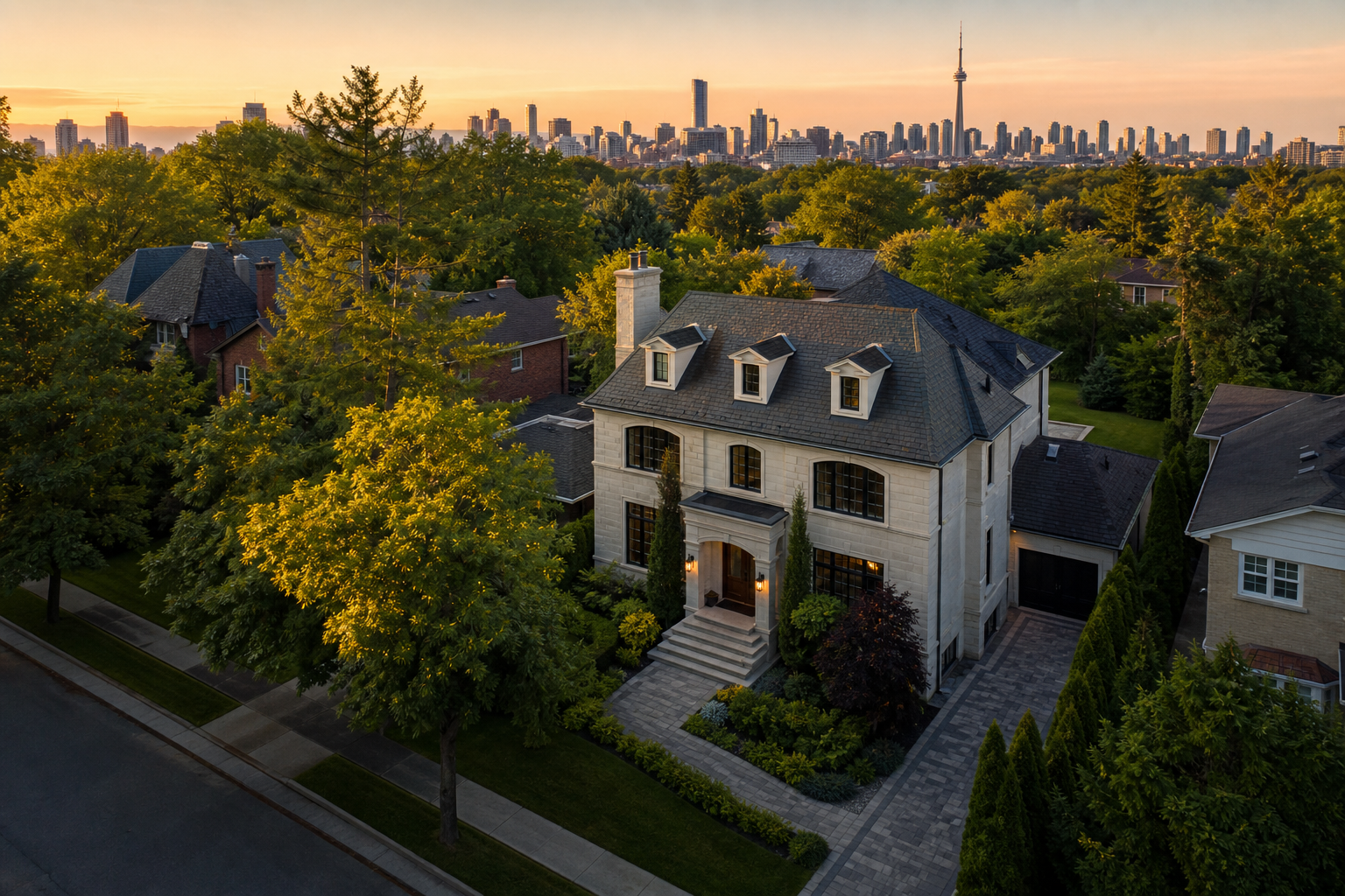
Drone real estate photography in Toronto can show buyers something ground-level images cannot: the full property, lot, neighbourhood and nearby amenities in one visual story. It is especially useful for detached homes, luxury estates, waterfront properties, development sites and listings near parks. However, Toronto’s controlled airspace, airports and hospital heliports make professional planning essential. This 2026 guide compares typical costs, package options, rules and practical benefits for Toronto agents and sellers.
1. Toronto Drone Photography Cost Comparison
Most Toronto real estate drone services cost between $150 and $900, depending on whether aerial coverage is added to a standard listing package or booked as a standalone production. Property size, deliverables, airspace requirements, travel and editing complexity can all affect the final quote.
- Drone photo add-on: $150–$300. Usually includes approximately five to fifteen edited aerial images when the operator is already completing interior photography or video at the property.
- Standalone aerial photography: $250–$500. Suitable when an agent only needs exterior aerial images, but the rate must also cover travel, setup, flight planning and editing.
- Drone photo and video package: $300–$650. Commonly combines edited aerial photographs with short video clips for a listing film, social media or MLS-compatible marketing.
- Cinematic aerial production: $500–$900+. May include multiple flight sequences, advanced editing, colour grading, music licensing and vertical versions for Instagram Reels, TikTok or YouTube Shorts.
For example, a North York detached home might need eight aerial photographs and three short video passes as an add-on to a full media package. A large Bridle Path estate may require more coverage, detailed route planning and a longer cinematic edit. The second project will usually cost more even if both properties are within Toronto.
2. Add-On Package vs Standalone Drone Service
Drone Add-On: Best Value for Standard Listings
An add-on is generally the most economical option because photography, video and drone coverage happen during one appointment. The agent can receive a consistent set of interior, exterior and aerial assets without paying for multiple site visits.
A practical package could include 30 interior and exterior photographs, eight drone images, a 60-second listing video and a 15-second vertical teaser. This format works well for detached homes where the backyard, lot depth or proximity to green space is an important selling point.
Standalone Drone Session: Best for Land and Exterior Stories
Standalone coverage is useful for vacant land, construction progress, commercial properties and listings where existing interior media is already available. It can also help relaunch a property with seasonal exterior visuals. Because the drone operator must make a dedicated trip, the cost per image is normally higher than an add-on.
Cinematic Package: Best for Luxury Marketing
Luxury productions use aerial footage as part of a broader visual narrative rather than as a simple overhead record. A video might open above a tree-lined street, descend toward the home and transition into stabilized interior footage. Separate horizontal and vertical edits can then support MLS pages, property websites and social advertising.
3. Drone Rules Toronto Agents Should Know
Commercial real estate drone work is governed by Transport Canada’s Canadian Aviation Regulations. Requirements depend on the aircraft, location and type of operation, not simply on whether the flight is paid or unpaid.
- Drone weight matters. Drones weighing 250 grams to 25 kilograms generally must be registered, and the pilot must hold the appropriate Transport Canada certificate. Microdrones under 250 grams have fewer certification requirements, but they still cannot be operated recklessly or in a way that endangers people or aircraft.
- Controlled airspace requires planning. Much of Toronto is affected by complex airspace associated with Toronto Pearson, Billy Bishop Toronto City Airport and other aviation activity. Depending on the drone and flight, an authorization may be required through the applicable system before takeoff.
- Airport and heliport locations matter. Hospital heliports and emergency aircraft routes can affect seemingly straightforward residential shoots. A professional operator should review current aeronautical information rather than relying only on a consumer flight app.
- People and buildings affect the operation. Pilot certification and drone specifications determine how closely an aircraft may operate near bystanders. Busy sidewalks, neighbouring yards and active roads may require a different launch point, timing or flight path.
- Property access is separate from airspace permission. A legal flight does not automatically provide permission to launch from private land, condominium property or restricted municipal locations. The production team should confirm access before the appointment.
- Privacy remains important. Camera angles should focus on the listed property and avoid unnecessary views into neighbouring windows, private yards or sensitive areas.
Rules, airspace conditions and authorization procedures can change. Agents should work with an insured operator who checks the specific address and current Transport Canada requirements before confirming that a requested shot is possible.
4. Five Listing Benefits of Aerial Media
1. It Explains Lot Size and Layout
Ground photographs can make it difficult to understand where a house sits on its lot. An elevated image can show frontage, backyard depth, a pool, detached garage, ravine boundary or corner-lot configuration in one frame.
2. It Adds Neighbourhood Context
Toronto buyers often evaluate access to parks, schools, transit corridors and commercial areas. A carefully composed aerial image can establish this context, although agents should avoid implying exact walking distances unless those claims have been verified.
3. It Makes Exterior Features Easier to Understand
Solar panels, landscaping, rooflines, outdoor entertaining areas and multi-building properties are easier to present from above. For example, an aerial angle can show how a laneway garage connects to the backyard and main residence.
4. It Creates Strong Opening Shots
A slow approach toward the property can provide a clear opening for a cinematic listing video. The same footage can be reframed into a short vertical clip, such as a five-second neighbourhood reveal followed by exterior and interior highlights.
5. It Helps Differentiate Premium Listings
Aerial media can make a campaign feel more complete when the property has a meaningful exterior story. Drone coverage does not guarantee a faster sale or higher price, but it can help buyers understand the listing and give agents more assets for digital promotion.
5. When Drone Photography Is Worth the Cost
Drone coverage provides the strongest value for detached homes with substantial lots, waterfront or ravine properties, luxury estates, farms, vacant land, commercial buildings and new developments. It can also benefit suburban listings where proximity to trails or green space is visually important.
It may offer less value for a small condo unit when the building exterior and surrounding skyline are already professionally documented. In that case, the budget may be better allocated to twilight photography, a detailed interior video or a vertical social-media edit. Condominium shoots can also involve launch restrictions and urban airspace challenges that make aerial coverage impractical.
6. How to Compare Toronto Drone Providers
Do not compare quotes only by image count. Ask whether the price includes flight planning, required authorizations, travel, editing, commercial usage and both MLS-ready and high-resolution files. Confirm the operator’s certification, registration and insurance where applicable. It is also helpful to review examples showing natural colour, straight horizons and controlled camera movement rather than heavily processed skies or abrupt flight paths.
For efficient marketing, choose a provider that can deliver photography, drone footage, cinematic video and vertical content during one coordinated appointment. This reduces scheduling and creates a more consistent visual identity across the campaign.
Need compliant, cinematic drone real estate photography in Toronto? Melon Media creates aerial photos, listing videos and social-ready vertical content tailored to each property. Book your Toronto real estate media session to request availability and a package recommendation.
Further reading
- Real Estate Video Pricing in Canada: 2026 Guide
- Real Estate Photography Prices in Canada: 2026 Guide
- Melon Media: Real Estate Media Studio Serving Toronto and the GTA
Further reading
- Real Estate Video Pricing in Canada: 2026 Guide
- Real Estate Photography Prices in Canada: 2026 Guide
- Melon Media: Real Estate Media Studio Serving Toronto and the GTA
Also see: Digital Estate Media Pricing in Canada: Photo, Video & Virtual Tour Packages
Ready to tell your story on camera?
Cinematic video production with 48–72h delivery, across Canada.